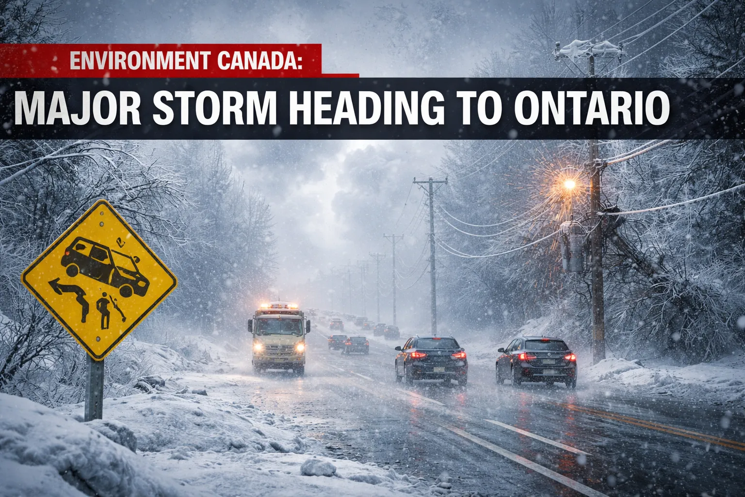
Weather forecasters are warning that a powerful storm system is expected to move across Ontario from Sunday through Tuesday, bringing a dangerous mix of heavy snow, freezing rain, rain, and strong winds. According to Environment Canada, the complex storm could affect large parts of the province and create rapidly changing weather conditions over several days.
Meteorologists say the system has the potential to cause hazardous travel conditions, power outages, and significant disruptions, especially as different types of precipitation fall across various regions. The storm is expected to begin with snowfall in some areas before shifting to freezing rain or rain depending on local temperatures.
Because the weather system will evolve as it moves across the province, forecasters say residents should be prepared for quickly changing conditions.
Storm Expected to Develop Sunday
The storm is forecast to begin forming on Sunday as a strong low-pressure system moves toward the Great Lakes region.
Early in the event, northern and central areas of Ontario may begin to see snowfall developing during the day. As the system strengthens, precipitation is expected to expand southward, gradually affecting more communities.
During Sunday night, changing temperatures could lead to a transition in precipitation. Some locations may see snow turning into freezing rain or ice pellets as warmer air moves into the region.
By Monday, the storm could reach peak intensity, bringing heavier precipitation and stronger winds before slowly weakening on Tuesday.
Weather systems like this are particularly challenging to forecast because snow, ice, and rain can occur in the same location within a short period of time.
Heavy Snow Possible in Northern Areas
Northern communities may experience the most intense winter weather as the storm moves across the province.
Forecasters say parts of northern Ontario could see significant snowfall totals, with some locations potentially receiving 30 to 50 centimeters of snow by the time the storm ends.
Strong winds may also create blowing snow, reducing visibility and making travel extremely dangerous. When heavy snowfall combines with strong wind gusts, conditions can quickly resemble a blizzard.
Regions near Lake Superior and sections of the Trans-Canada Highway could experience some of the most difficult travel conditions during the storm.
Local authorities often warn drivers to avoid unnecessary travel during such events, as roads can become hazardous within minutes.
Ice Accumulation Risk in Central Ontario
While northern areas may see mostly snow, central regions of the province face a different threat — freezing rain and ice buildup.
Freezing rain occurs when falling rain passes through a layer of warm air before reaching cold air near the ground. As the rain hits surfaces such as roads, trees, and power lines, it freezes instantly and forms a layer of ice.
Even a small amount of freezing rain can create dangerous conditions. Ice accumulation can cause tree branches to snap and may lead to power outages if power lines become weighed down.
Meteorologists say several millimeters of ice accumulation could be possible in some parts of central Ontario if temperatures remain near the freezing point.
Rainfall Expected in Southern Regions
In southern parts of the province, temperatures may climb above freezing during parts of the storm.
When this happens, precipitation may fall mainly as rain instead of snow. Some areas could see rainfall totals between 30 and 50 millimeters, especially during the peak of the storm.
Heavy rainfall combined with melting snow can increase the risk of localized flooding. Low-lying areas, rivers, and storm drains may become overwhelmed if water levels rise quickly.
Meteorologists also say that as warmer air pushes into the region, isolated thunderstorms cannot be ruled out, adding another layer of complexity to the storm system.
Strong Winds Could Add to the Damage
Wind is another major factor that could increase the storm’s impact.
Forecast models suggest wind speeds could reach 70 kilometers per hour across many areas, with some gusts potentially approaching 90 or even 100 kilometers per hour.
Strong winds during winter storms can cause a variety of problems, including:
Falling tree limbs
Power outages from damaged power lines
Damage to outdoor structures
Dangerous driving conditions for trucks and larger vehicles
When strong winds combine with heavy snow or ice, the risk of travel disruptions and property damage increases significantly.
Travel Disruptions Likely Across the Province
Transportation officials are urging residents to stay updated on the latest forecasts as the storm approaches.
Snow-covered roads, icy surfaces, and poor visibility can make driving extremely dangerous during major winter storms.
Major highways and rural roads throughout Ontario may experience closures or significant slowdowns if snowfall and ice accumulation become severe.
Air travel could also be affected, especially at large airports if snow or freezing rain impacts runway operations.
Officials often advise drivers to carry emergency supplies during winter travel, including blankets, food, water, and a fully charged phone.
Why Great Lakes Storms Are So Complicated
Storm systems in the Great Lakes region often become complicated because they involve multiple competing air masses.
In this case, the approaching system is expected to interact with cold Arctic air moving south while warmer air pushes north from the United States.
This clash between cold and warm air creates the perfect conditions for a wide range of precipitation types, including snow, freezing rain, sleet, and rain.
Because temperature differences can be very small — sometimes just a few degrees — weather conditions can change rapidly from one form of precipitation to another.
This is why forecasters often describe such storms as “complex” or “multi-phase.”
Preparing for Severe Winter Weather
Authorities recommend that residents take several steps to prepare before the storm arrives.
Safety experts suggest:
Monitoring updates from Environment Canada
Charging phones and backup batteries in case of power outages
Securing outdoor items that could be blown away by strong winds
Stocking essential supplies such as food, water, and medications
Avoiding unnecessary travel during the worst parts of the storm
Preparing ahead of time can help reduce risks and make it easier for families to remain safe if conditions worsen.
Storm Conditions May Continue to Evolve
Meteorologists emphasize that forecasts may continue to change as the storm develops.
Large weather systems often shift slightly in track or intensity, which can dramatically alter snowfall totals or ice accumulation across different regions.
For now, residents across Ontario are being urged to stay informed and prepared as the storm approaches.
Although winter is slowly giving way to spring, this upcoming system serves as a reminder that severe winter weather can still strike with little warning, bringing a powerful mix of snow, ice, rain, and wind across the region.